Reliable climate data is essential for understanding groundwater systems. In regions such as the Lower Rhine Valley in Germany, where groundwater supplies both ecosystems and agriculture, accurate estimates of precipitation and evapotranspiration are essential for assessing recharge and contamination risks.
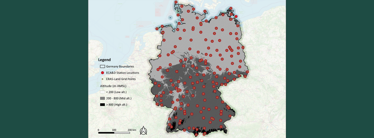
To test the suitability of reanalysis products for such applications, ERA5-Land data were compared with data from 174 ECA&D (European Climate Assessment & Dataset) stations across Germany for the period 2011–2020. ERA5-Land provides hourly data with a resolution of approximately 9 km, while ECA&D offers daily ground observations.
ERA5-Land shows for precipitation:
- An overestimation at low and medium altitudes, particularly in spring (March–May) and winter (December–February).
- An underestimation at high altitudes, with annual mean biases within ±25%.
- An underestimation of spatial variability (standard deviation ratio ≈ 0.8; spatial correlation ≈ 0.7).
- Excellent temporal agreement with ECA&D (temporal correlation > 0.95; CRMSE < 0.2).
ERA5-Land increasingly overestimates reference evapotranspiration (ET₀) with elevation, with the mean bias being small at low altitudes, moderate at medium altitudes, and notably larger at high altitudes, especially during spring (March–May) and summer (June-August).
The results of the precipitation analysis are consistent with previous assessments (e.g., Hammoudeh et al., 2025) and confirm that ERA5-Land reliably captures temporal climate dynamics but tends to smooth out local spatial variations.
ERA5-Land offers high temporal accuracy and broad coverage for groundwater modelling. When properly validated and adjusted, it is a reliable source of climate data for assessing recharge and contamination dynamics in vulnerable aquifers such as Jülich Zwischenscholle. These data are essential for understanding and protecting groundwater resources under increasing environmental pressure.

