Unsere Anwendungsfälle
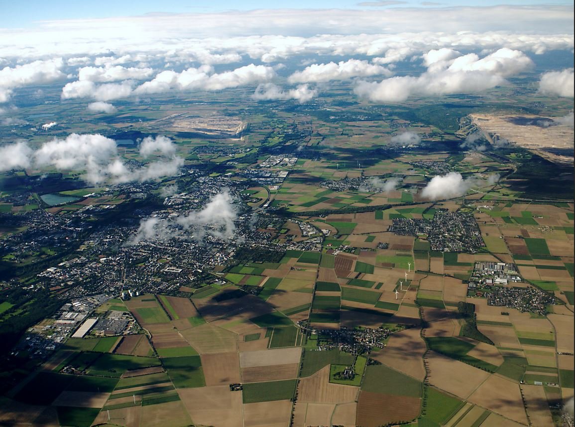
Der Grundwasserleiter Zwischenscholle befindet sich in der Niederrheinischen Bucht, Deutschland. Der Untergrund besteht aus ungespannten und halbgespannten quartären Rhein- und Maassedimenten, die hauptsächlich sandig und kiesig sind. Die Basis des Grundwasserleiters ist der wasserundurchlässige Reuver-Ton. Die Mächtigkeit des Grundwasserleiters schwankt zwischen einigen Metern im Südwesten und 35 m im Nordosten. Das Grundwasser fließt von Südosten nach Nordwesten. Dieses Gebiet wird hauptsächlich durch Wälder und landwirtschaftliche Flächen genutzt. Die typische Fruchtfolge besteht aus Zuckerrüben und Winterweizen. Kartoffeln, Hafer und Mais wurden in geringem Umfang angebaut. Aufgrund der geringen Tiefe des Grundwasserspiegels und der intensiven landwirtschaftlichen Nutzung in diesem Gebiet wurde die Anfälligkeit des Grundwasserleiters für eine Verunreinigung durch Pestizide als sehr hoch eingestuft. Der Zwischenscholle-Grundwasserleiter ist einer der Grundwasserleiter weltweit die mit Atrazin, einem der weltweit am häufigsten eingesetzten Pestizide zur Unkrautbekämpfung, kontaminiert sind.
Agrarfläche (Ackerland, Grasland) & Wald

Pestizide

Boden und Grundwasser
Prozesse
Wasserfluss und Transport von Pestiziden in Böden und Grundwasser.
Aktionen und erwartete Ergebnisse
- Prüfung der Auswirkungen der Verwendung EU-weit verfügbarer Daten über Boden- und Grundwasserleitereigenschaften und Flächennutzung auf die Vorhersage der Dynamik des Grundwasserspiegels und der Pestizidkonzentrationen im Grundwasser.
Herausforderungen
- Ein Vergleich zwischen simulierten und gemessenen Pestizidkonzentrationen ist schwierig, da die Dosis und der Zeitpunkt der Pestizidanwendungen nicht bekannt sind.
- Kleinräumigere Merkmale sind in dem großmaßstäblichen Simulationsmodell (Auflösung 600 x 600 m) nicht dargestellt.